Date: 6th October, 2014
Distance: 6 km (return)
Time: 3.5 h
Main Range National Park Map

Spicer's Peak rises 1222 m above the Fassifern Valley and sports a distinctive, rocky pyramidal spire. I've been keen to do this walk since visiting Spicer's Gap back in May for the Mount Mathieson Circuit, but the ideal combination of a free morning plus clear skies eluded me until last weekend.
This "off-track" hike is one of the more challenging walks I've done in SEQ, involving a 2 hour steep climb, some scrambling and tramping over crumbly tracks. Aside from a small section of rainforest at the top, the track runs through open forest and it was extremely hot by the time I was back at the car at 11am. The 1.5 L of water I took was barely enough to last this long, and there are no fill up points along the way.
Although the route is not marked in the National Park Map linked above, the walk begins at Governors Chair Lookout, a spectacular rocky outcrop 150 m from the end of Spicer's Gap road. If you arrive early enough you can savour it without the hordes of people that appear later. From here a series of obvious footpads head southwards, directly towards Spicer's peak. I just followed the main one, but minor tracks crossed the path here and there, and this caused some confusion on the return journey. Dalys' ever-faithful Take A Walk guidebook indicates you can follow a fenceline to aid navigation, but it must have been removed since publication because I saw none.

From here it is all uphill! The gradient is gentle at first, and looking back, the southern profile of Mount Mitchell slowly emerges above the eucalyptus trees.
 |
| Mount Mitchell's double humped profile |
When the path levels at a wide clearing, views extend east over the Fassifern Valley.
 |
| Looking north-east towards Mounts Edwards, French and Greville surrounding Lake Moogerah |
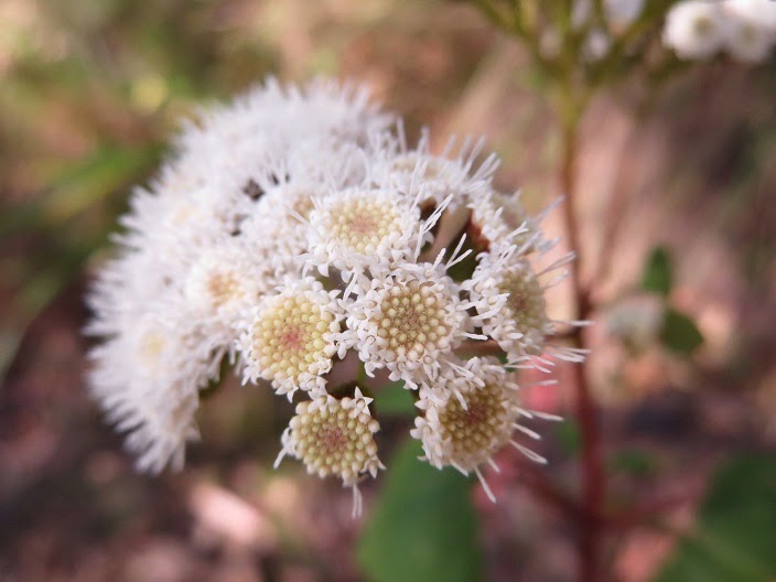
From here, the track becomes steadily steeper until stopping every few minutes for a breather sounds like a good idea. A nice surprise was finding the mountainside alive with wildflowers after hitting a certain altitude - a Springtime bonus.


Eventually the track diverts around to the right to avoid a seemingly unscalable dirt-covered rock (with some scrambling involved anyway), and shortly afterwards you hit the first cliffline. Apparently the original route was directly up the cliff, but thankfully you can work your way right (westwards) to negate this dangerous section.
 |
| The Springtime bonus was also a burden, as the bees made their presence known |
I followed the cliffline, looking for a break where I could then begin to ascend again. I read other trip reports suggesting that it can be easy to miss the right spot and travel too far west (or else try to ascend too early), but I found it fairly obvious. I noted a certain tree at this point as a marker for descent, which later proved to be invaluable.
 |
| This distinctive tree was a good marker to remember where the cliff break was |
A small rocky slab here required some minor scrambling, then it was uphill again until I met the second cliffline.
 |
| Minor scrambling involved, but nothing like scaling the cliff at the eastern point |
The path clearly headed back eastwards (left) from the second cliff at a little cleared area that was devoid of bushes for some reason. Multiple footpads emanate from here and after following a couple, I eventually found myself sort of bush bashing eastwards and upwards through the grass trees and flowering bushes until I made the top of the ridge.
 |
| There's a path there... somewhere |
From the top of the ridge there were glorious views everywhere.
 |
| Looking south along the main range, and further east (left) to Mounts Barney and Maroon |
And the summit so close...
 |
| The 'classic' view of Spicer's Peak's summit |
The Take A Walk guide suggested to follow a track diagonally right and upwards from this point towards the peak, but I found it easy enough just heading directly up to the third cliffline before contouring right to meet a small rainforested region.
 |
| Sidling along under the final cliffline... it's a long way back down |
The ground was particularly steep/crumbly through the rainforest, and fallen trees, hanging vines and hidden stinging plants combined to make the short scramble to the summit a workout. Views from the top are limited due to the thick vegetation, but you are at least shielded well from the heat.
 |
| Rainforest on top of Spicer's Peak |
I lost the track several times on the return journey, as the long grasses often disguised the main path. The best advice I can give is to keep close to the bottom of each cliff line to avoid the steep drop offs near the cliffs below, and this is also where the main path tends to be.
No comments:
Post a Comment